the full distance / 22 km / 2800 m elevation gain / 200 spots
Seven Sisters
Key Info
Distance: 22 km
Elevation gain: 2800 m
Spots: 200
Date: 22.08.2026
Peaks
Breitinden / Stortinden 910 m
Kvasstinden 1013 m
Tvillingan 980 m / 945 m
Skjerdingen 1037 m
Grytfoten 1019 m
Botnkrona 1072 m
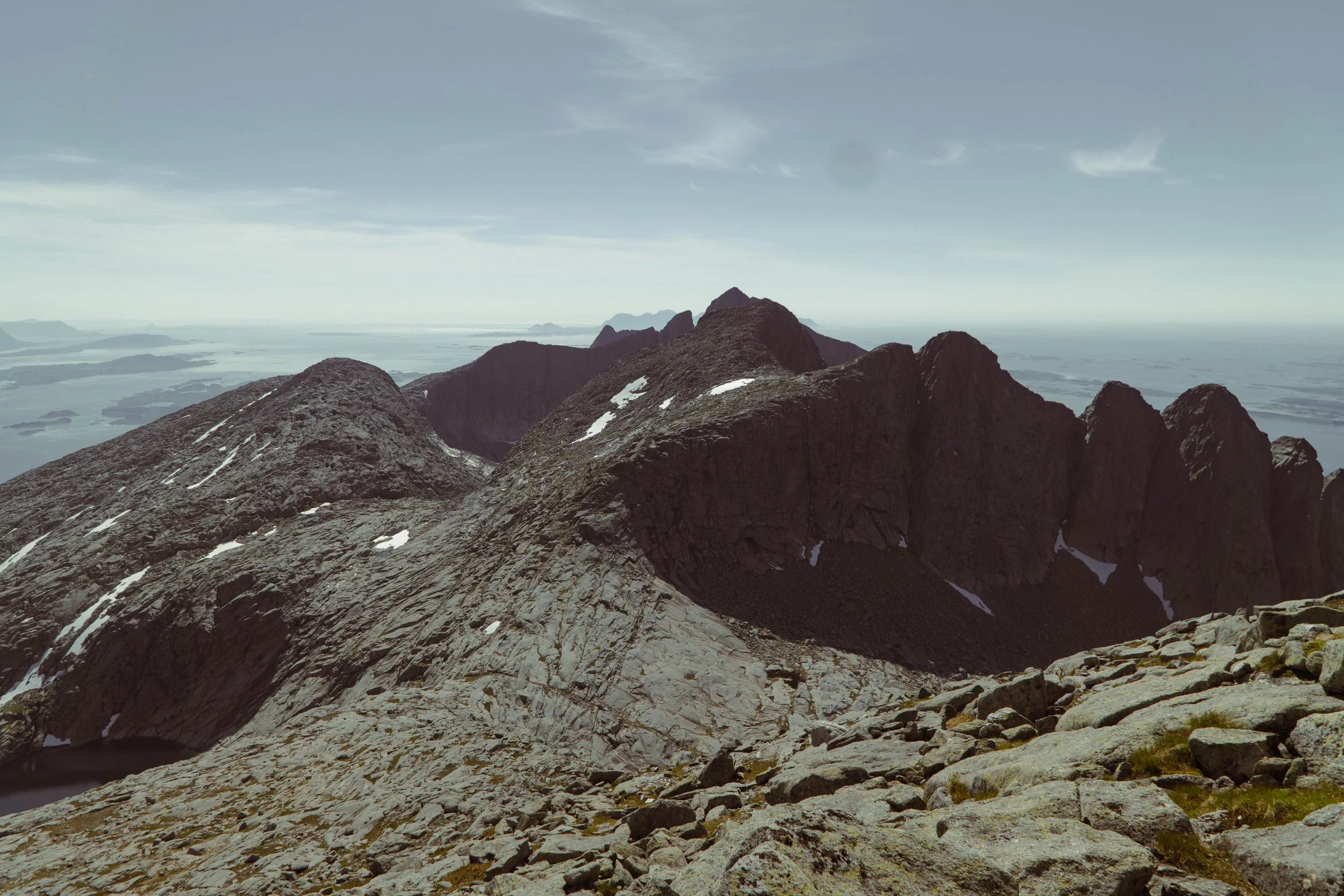
Course description
The full distance over all the seven sisters offers technical terrain with steep uphill and downhill sections that will put both your physical and mental capabilities to the test.
The race starts at the southwest end of the mountain range. After less than 3 km you will reach the first summit, Breitind (910 m). At Bretind you will both get a fantastic view of the Helgeland coast line and a look at the upcoming peaks.
From there you will face a challenging descent which likely will take you through a section of last winters snow. The next peak on your journey is Kvasstinden (1,018 m).
From Kvasstinden, a longer traverse brings you to the Twins (Tvillingan) — first the Southern Twin (980 m), then the Northern Twin (945 m), separated by just a short saddle.
Next is Skjerdingen (1,037 m), where rough ridges and boulder fields reward precise footwork, followed by Grytfoten (1,019 m), a final grind before the high point.
The last and highest summit is Botnkrona (1,072 m). Tag the top, take in the view, and steel yourself for the long, rugged descent toward the finish — a section that includes fixed ropes in places and demands full focus all the way down. Be aware, the last downhill is longer than you think.
Mandatory equipment:
Windproof jacket
Cap, Buff, or equivalent
Fully charged mobile phone
Emergency blanket (rescue sheet)
Bottle (minimum 1L of liquid at start)
Nutrition
Wool base layer/top (if weather conditions require it)
In addition, we require that all participants download the gpx file and use it on a capable device (sports watch or mobile phone). The file will be available for later, for now you can view the route on the Strava route below.
Participation in the event requires full acceptance of the official race regulations. Click here to read them.